
Hurricane Erick has re-emerged as a significant weather event in the 2025 Pacific hurricane season. Formed over warm ocean waters in early June, this tropical system quickly gained strength, prompting meteorologists and emergency services to track its movement closely. With wind speeds nearing Category 2 strength, Hurricane Erick poses real concerns for coastal and island communities in the eastern Pacific.
While not expected to make direct landfall on mainland U.S., its outer bands are generating heavy rains, elevated surf, and wind warnings in multiple zones, particularly affecting Hawaii and surrounding maritime routes. Authorities are urging residents to stay informed as the storm’s trajectory may change rapidly.
Meteorological Breakdown: Formation and Behavior
Atmospheric Conditions That Fueled Erick
Hurricane Erick was first observed as a tropical depression south of Mexico. Warm sea surface temperatures exceeding 28°C, combined with low vertical wind shear, created the ideal conditions for rapid intensification.
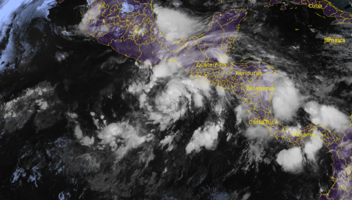
By June 17, the National Hurricane Center classified it as a Category 1 hurricane. Satellite imagery revealed a well-organized central core and an increasingly defined eye, signaling strong atmospheric support and sufficient energy for further development.
Forecast Path and Wind Projections
As of the latest update, Erick is moving west-northwest at approximately 14 mph. Wind speeds peaked at 85 mph, with gusts reaching up to 100 mph in the core storm area. The system is forecasted to weaken gradually as it enters cooler waters, but its influence on surrounding regions remains considerable.
Meteorologists project tropical-storm-force winds extending outward up to 140 miles from the center, with isolated locations experiencing severe gusts, flash flooding, and disrupted travel conditions.
Areas Under Advisory and Localized Effects
Hawaii and Island Communities
The storm is not currently forecast to make direct landfall in Hawaii, but its outer rain bands are expected to bring high surf, localized flooding, and travel disruptions. Authorities have issued coastal warnings, advising beachgoers to stay away from strong rip currents and large swells.
Marine and Aviation Disruptions
Several cargo and passenger routes in the eastern Pacific have already experienced delays. High-altitude wind shear also has the potential to impact air travel. The U.S. Coast Guard has advised vessels to avoid the path of the storm entirely.
Emergency Preparedness and Safety Alerts
Community Advisory Systems
The National Oceanic and Atmospheric Administration (NOAA) and local emergency agencies continue to provide regular updates. Residents are encouraged to monitor weather apps, NOAA radio, and local broadcasts for the latest storm information. Evacuation zones are not yet in effect but may be announced if the trajectory shifts.
Basic Preparedness Checklist
- Secure outdoor items such as trash bins and furniture.
- Keep a battery-powered flashlight and extra batteries available.
- Charge electronic devices in case of power outages.
- Avoid unnecessary travel near coastal and mountainous regions.
Environmental and Long-Term Impact
Coastal Erosion and Rainfall Accumulation
Even without landfall, Erick’s size is contributing to beach erosion in certain areas and elevated tide levels. Rainfall accumulation is predicted to reach 4–6 inches in some spots, increasing landslide risks in hilly terrain.
Potential Role of Climate Trends
Experts are analyzing Erick within the broader context of climate patterns. Warmer sea temperatures, largely attributed to long-term shifts in climate behavior, may have contributed to Erick’s rapid intensification.
Media Coverage and Public Awareness
Social media has played a pivotal role in circulating storm updates. Hashtags such as #HurricaneErick and #PacificStorm2025 are trending, helping communities share footage, status updates, and safety tips. However, officials urge caution, as misinformation can spread just as quickly.
What to Watch in the Coming Days
The next 72 hours are crucial in determining whether Erick weakens as projected or maintains its strength. If wind shear increases and ocean temperatures drop, the storm may dissipate sooner than anticipated. However, any shift in course could dramatically change regional outcomes.
Residents in Hawaii, southern Baja California, and surrounding island chains should remain alert and prioritize official weather updates over speculation.
Conclusion
Hurricane Erick 2025 serves as a clear reminder of nature’s unpredictability and the importance of preparedness. While it may not make direct landfall, its reach is wide, and its impact is real—from high tides and flooding to travel disruptions and public safety measures.
Staying informed through reliable sources, preparing proactively, and understanding the dynamics of storms like Erick are essential for reducing risk and ensuring community safety.
FAQs
1. Is Hurricane Erick expected to hit Hawaii directly?
No. While Erick’s core is not expected to make landfall in Hawaii, outer bands may affect the islands with heavy rain and high surf.
2. What category is Hurricane Erick as of now?
It is currently a Category 1 hurricane, with maximum sustained winds around 85 mph.
3. How can residents stay updated about Hurricane Erick?
Residents should monitor NOAA alerts, local news channels, and official government weather websites for real-time information.
4. Are evacuation orders in place?
As of now, there are no mandatory evacuations. However, residents should be prepared in case the storm’s path changes.
5. How long will Hurricane Erick last?
The storm is expected to weaken within the next few days, but its effects—such as rain and surf—may linger through the weekend.